Plan and Prepare
Plan and Prepare with Us!
Preparing yourself and your family for emergencies can feel overwhelming. There is a lot of information out there. It is not always easy to know where to start. To help, we gathered trusted preparedness resources and posted them below.
Our best advice? Start where you can. You don’t have to do everything at once. Even small steps can help you be more prepared tomorrow. Every step you take helps make Benton County safer and better prepared.
EMERGENCY NOTIFICATIONS
Sign up for local and statewide alerts. Linn-Benton ALERT sends emergency messages for our area. It also connects you to Oregon’s OR-Alert system.
Linn-Benton ALERT via the Everbridge Community Profile
Sign up to get emergency alerts for your area. Linn-Benton ALERT uses the Everbridge Community Profile to send important safety messages during emergencies. By creating a profile, you can choose how and where you get alerts- by phone call, text message, or email- so you get critical information when you need it most.
Flash Alert
Integrated FlashAlert is used by many local police and fire agencies, as well as schools and other community/government organizations to send emergency messages. You can register to get news releases and emergency notification. You choose the agencies you wish to hear from. Register for FlashAlert now.
OR-Alert
Interested in alerts from multiple regions around Oregon? OR-Alert is your one-stop shop to get registered for alerts across all 36 counties and tribal governments. Register for OR-Alert now.
LOCAL EMERGENCY PREPAREDNESS APP

Add a little preparedness power to your phone! The HazAdapt app is your on-the-go hazard guide with step-by-step emergency and disaster information—whether you’re at home, at work, or traveling. Keep emergency instructions, preparedness tips, and community resources at your fingertips!
EMERGENCY PREPAREDNESS SITES
Preparing yourself and your family for emergencies can feel overwhelming. After all, there is a lot of information out there. To help, we gathered trusted preparedness resources and posted them below. Here, you can find tools to build a kit, make a plan, and learn what to do in different emergencies.
- Build Your Kit
- Low and No Cost Preparedness Planning
- Be 2 Weeks Ready
- Be Financially Prepared
- Get Tech Ready
- Older Adults
- Ready.gov: People with Access & Functional Needs
- Emergency Preparedness Toolkit for People with Disabilities
- Emergency Preparedness Resource Hub for People with Disabilities
- Emergency Preparedness Guides from the Occupational Safety and Health Administration
- Evacuation
- Types of Shelters
- Safety Skills
- Make a Plan for all Locations
- For kids: Prepare with Pedro Activity & Storybooks (Basic Preparedness, Earthquake, Wildfire, Flood, Winter Storm, Extreme Heat)
GET TO KNOW YOUR LOCAL HAZARDS
Learn about the natural and hazards caused by people that impact Benton County. These resources help you understand what risks exist in our region so you can make informed choices and strengthen your preparedness.
Road Conditions
Benton County Road Closures
The Benton County Road Department works to keep county roads safe and open. Check road closures and updates, or report a road problem or concern, on the Benton County Road Department website.
Benton County Snow and Ice Route Prioritization
Snow plowing and road sanding are done based on priority. View the snow plowing and sanding priority map.
Trip Check
Provided by the Oregon Department of Transportation (ODOT), TripCheck is a helpful tool for checking road conditions before you travel. Check your route using TripCheck.
Flooding and River Conditions
Benton County Sandbag Fill Stations
Benton County provides several sandbag filling stations for the public. Empty bags are available at the stations, or you can pick up bags at the Public Works yard. Please bring your own shovel. View the sandbag filling station locations.
River Information and Forecasts
The National Oceanic and Atmospheric Administration (NOAA) provides 4–10 day river trend forecasts. You can view current conditions and forecasts for:
The Willamette Basin River and Dam Status
The U.S. Army Corps of Engineers provides a map showing current river and dam levels in the Willamette River Basin. View the interactive river and dam level map.
Weather and Air Quality
National Weather Service
View local weather forecasts, active alerts, radar, river levels and more.
Air Quality in Oregon
The Oregon Department of Environmental Quality provides a map showing current air quality across Oregon. Check the map to view your local Air Quality Index (AQI).
Wildfire and Power Outages
Oregon Statewide Wildfire Hazard Map
Oregon’s statewide wildfire hazard map was developed through a partnership between Oregon State University (OSU), Oregon Department of Forestry (ODF), Oregon State Fire Marshal (OSFM), and the Department of Consumer and Business Services (DCBS). Learn more and view the interactive wildfire hazard map.
Oregon Wildfire Information
InciWeb is an interagency system that shares information about active incidents. You can view local wildfire information using:
Pacific Power Outage
Experiencing a power outage? View the outage map or report an outage by texting OUT to 722797.
Consumer Power Inc. Outage
Experiencing a power outage? View the outage map, report an outage by calling (541) 929-3124, report online through your CPI account, or use the CPI SmartHub app and select “Report an Outage.”
Earthquake and Geologic Hazards
Find Geohazards in Your Neighborhood
You can use the HazVu map to see earthquake, landslide, and other geologic hazards near your address.
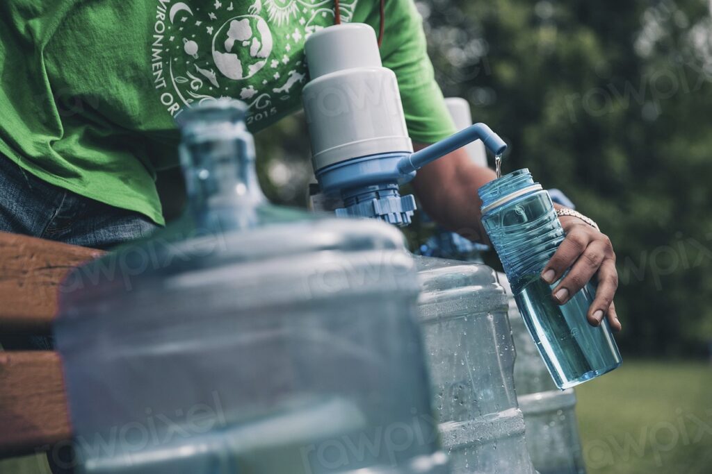
WATER TIPS


FOOD TIPS


PREPARE YOUR PETS & LIVESTOCK


More Links from the Humane Society of the United States:
DISASTER MANAGEMENT OF MEDICAL DEVICES
Pacific Power- Medical Baseline Program– assistance program for residential customers who may have energy needs related to qualifying medical conditions.
The Oregon Health Authority provides eligible people air conditioners and air filters. These devices can help keep you safe during extreme heat and smoky conditions. Apply for the Air Conditioner and Air Filter Deployment Program.
U.S. Food & Drug Administration offers tips about Medical Devices and Natural Disasters.
For more information, email the team at emergencymanagement@bentoncountyor.gov or give us a call at 541-766-6864.